

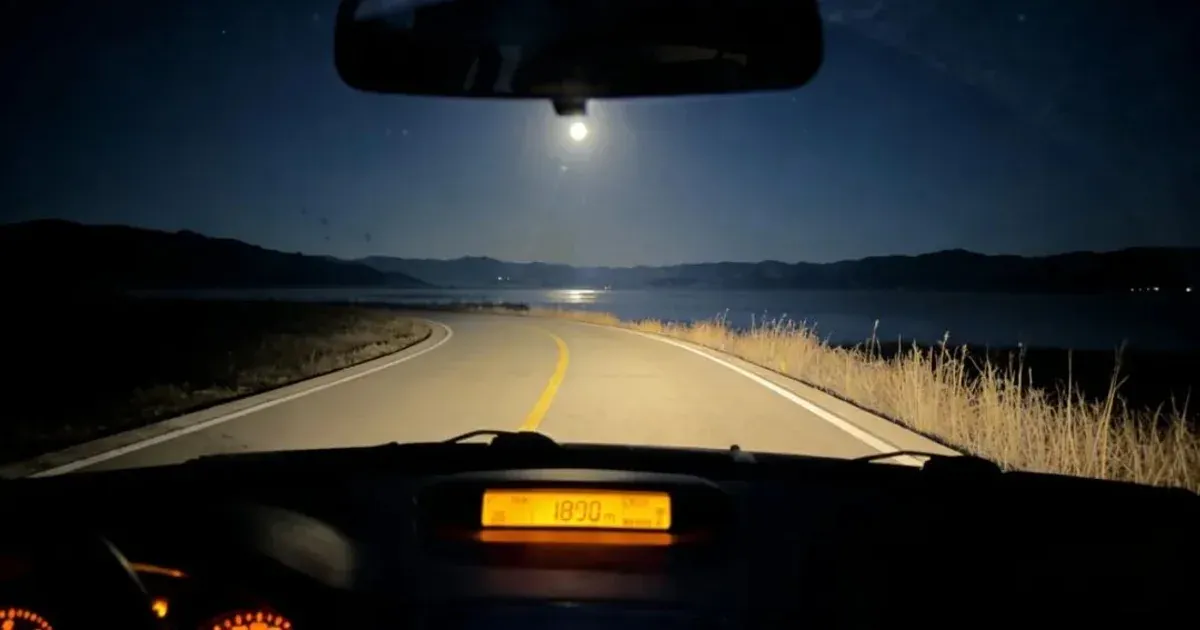
Weining Caohai: Strong winds, low skies, and the quiet of a high-altitude wetland
A trip to Weining Caohai isn't a lighthearted 'healing getaway.' The high-altitude winds, wetlands, shifting weather, and long drives redefine the scale of Guizhou's outdoors.
On this page

Don’t just look at photos of Weining Caohai.
In pictures, it’s often just blue skies, wetlands, migratory birds, and boardwalks—a gentle plateau backdrop. But when you actually arrive, the first thing you notice isn’t beauty; it’s the wind.
The wind sweeps off the lake, carrying moisture that chills your face. Clouds hang low. The distant mountains aren’t as close as those around Guiyang, stretching out the space. You suddenly realize you’re no longer within your familiar urban radius.
The weather wasn’t perfect when I visited Caohai. It hovered somewhere between “doable” and “uncertain.” And precisely because of that, this trip was worth documenting.
Route Overview
| Item | Recommendation |
|---|---|
| Type | Plateau wetland / Self-drive / Light hiking |
| Best time | More comfortable in stable weather; be conservative on rainy days |
| Key sensations | Strong winds, rapid sunlight changes, significant temperature swings |
| Gear | Windbreaker, hat, raincoat, thermos, comfortable shoes |
| Risks | Driving fatigue, sudden weather shifts, cold winds, slippery boardwalks |
Caohai Isn’t Just a “Leisurely Stroll”
On a map, Caohai doesn’t look intimidating. It’s not a snow mountain or a canyon, lacking obvious danger. But plateau wetlands have their own way of draining you.
The wind blows constantly, making your head feel tight after walking for a while. When the sun comes out, it’s hot; when clouds roll in, it gets cold. You might think you’re just walking along a boardwalk, but your body is constantly adapting to the changes.
This is different from strolling through a park in Guiyang. The sense of space at Caohai is much larger, and turning back relies heavily on your vehicle and the weather. Especially if you drive there, factor in the energy needed for the return trip. Don’t spend all your stamina on-site; the drive back is the true finale.
Why I Like This “Imperfect Weather”
Perfect weather is nice, but imperfect weather feels more like real life.
That day, the clouds over Caohai were constantly shifting. There was a patch of brightness in the distance, while the foreground remained gray. The wind created fine ripples on the water surface. Standing by the boardwalk, watching the reeds fall one by one, I suddenly felt this place didn’t need many adjectives.
Many outdoor articles love to write about “healing.” I’ve become wary of that word lately. Nature isn’t responsible for healing you; it just places you back into a larger system. Within it, you feel smaller, and so do your problems.
As someone who writes code long-term, I deal daily with artificially created complexity: APIs, pages, data, deployments, content. At Caohai, complexity becomes wind, clouds, water, and roads. It’s not necessarily simpler, but it’s more real.
Take Fewer Photos, Be Less Greedy
Caohai is great for wide landscapes, but it’s easy to end up with empty shots. The wetlands, sky, and water are all broad. Without foreground elements, photos can look scattered.
I recommend focusing on boardwalk corners, edges of the reed beds, textures of wind-blown water, or the backs of companions. Don’t always try to fit the entire Caohai into one frame. Often, a small patch of wet grass, a single bird, or a stretch of low clouds creates more memorable images than a panoramic shot.
If using a drone, watch the wind carefully. In places like Caohai, wind isn’t always visible to the naked eye, but its effect on flight is obvious. Don’t maximize risk just for one shot.
Birdwatching Has Limits: The Habitat Comes Before the Photograph
This account records an earlier personal visit to Weining Caohai. It does not verify which trails, viewing areas or drone operations are legally accessible today. Caohai is a national nature reserve, not an unrestricted waterfront recreation site.
China’s National Forestry and Grassland Administration reported in January 2026 that the nature reserve had suspended boating tourism, closed docks and implemented restrictions on lake visits and fishing as part of habitat restoration. An April 2026 conservation commentary specifically criticized drones chasing migratory birds at Weining Caohai and disturbing wintering black-necked cranes. Do not infer that a route is open, boat access is available or a flight is permitted from an old travel photograph. Follow current reserve notices and on-site management instructions.
A better birdwatching habit is to remain in legally open public locations, observe quietly from a safe distance, and avoid feeding, baiting, chasing, nest disturbance or drone pursuit. Some days the right photograph is no photograph. National guidance also emphasizes not entering protected areas without authorization and not disrupting migratory birds.
Official references: Caohai restoration, January 2026 · Responsible bird photography, April 2026 · Migratory bird protection guidance.
How to Judge “Rainy Edge” Conditions
Outdoor activities in Guizhou often present this scenario: the forecast says light rain, and it looks walkable on site. This is when mistakes happen most easily.
My judgment is simple:
First, check if the clouds are lowering further. Lower clouds mean poorer visibility and potentially colder winds.
Second, assess ground slipperiness. Boardwalks, stone slabs, and wooden planks become significantly more hazardous when wet.
Third, observe your companions’ state. If anyone is already cold, tired, or uncommunicative, don’t push further out.
Fourth, consider the return time. The biggest risk with long-distance self-driving trips is being too absorbed in the activity to notice fatigue setting in for the drive back.
That day, I didn’t walk far. After seeing the core area and taking some photos, I started heading back. I felt a bit reluctant leaving, but by evening, back at my accommodation, I felt good about that decision.
How to Approach Writing About Caohai
I don’t want to frame Caohai as a “must-visit.” It’s not for everyone.
If you’re looking for a relaxed, lively spot, Caohai might be too far, too cold, and too empty. If you seek a place that helps you quiet down, it’s very suitable.
Its beauty isn’t adrenaline-pumping. It won’t grab you instantly like a canyon or snow mountain. Instead, it gradually turns down the volume, letting you hear the wind, your footsteps, and your own breathing.
This is quite luxurious for programmers. We spend too much time being pushed by notifications and having our tasks fragmented. A place like Caohai allows you to experience continuous time again.
Conclusion
What Weining Caohai gives me is a feeling of “width.”
It’s not about the physical width in the photo, but a sense of psychological spaciousness. Standing there, you realize many things don’t need to be dealt with immediately. The wind blows, clouds drift on, and waterbirds won’t change course just because you’re anxious.
This trip had no perfect weather and no thrilling stories. But it confirmed one thing for me: the outdoors doesn’t have to prove its value through difficulty. Sometimes, a trail that allows you to find peace is enough.
Keep Moving
Next step: continue with related field evidence
Full decision path →Follow the next route, condition, gear, or firsthand record that helps make a real decision.

DISCUSSION
Questions, verification and corrections
Sign in to comment. Every new comment is reviewed before publication; while pending, it is visible only to you and the administrator.